
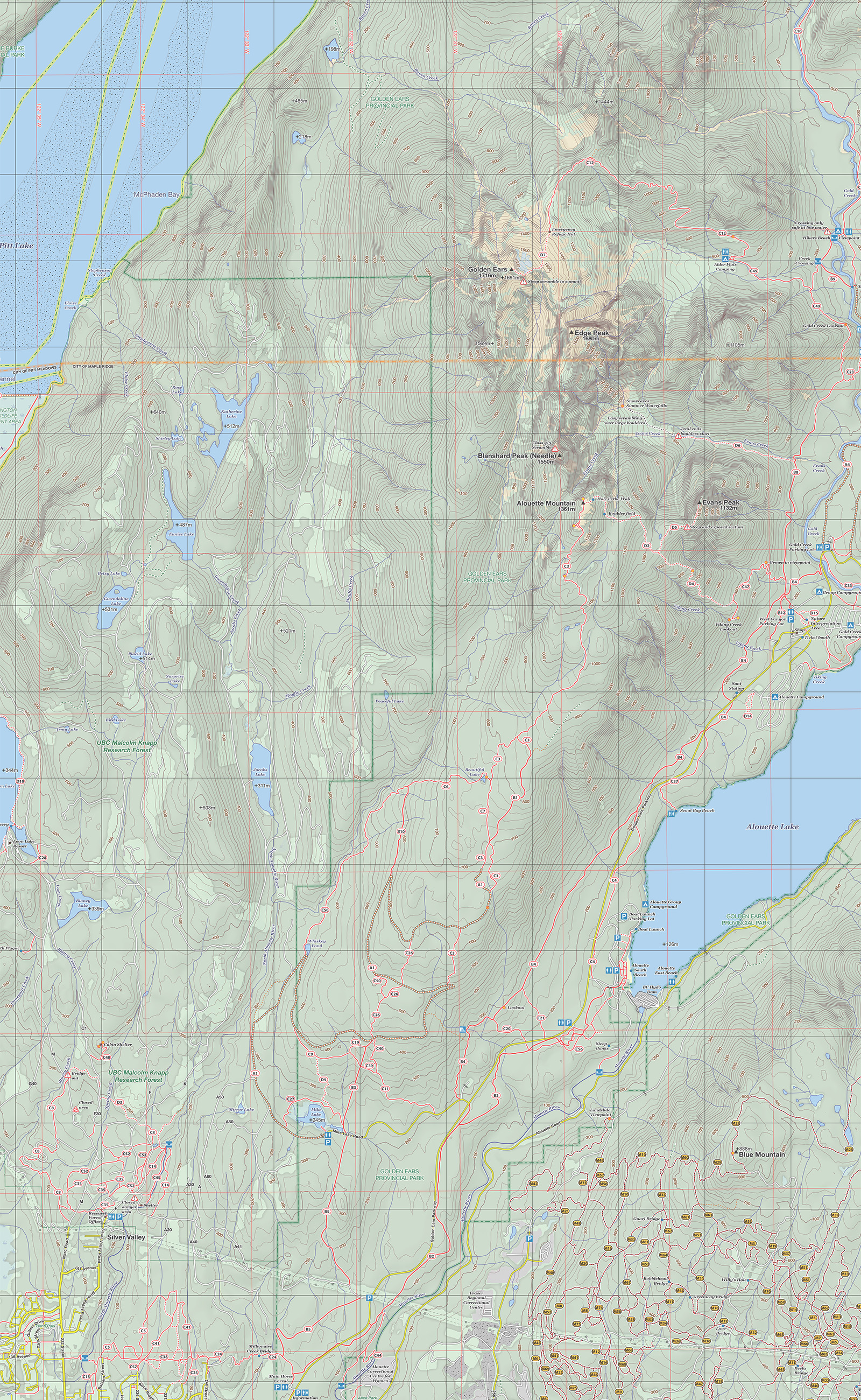
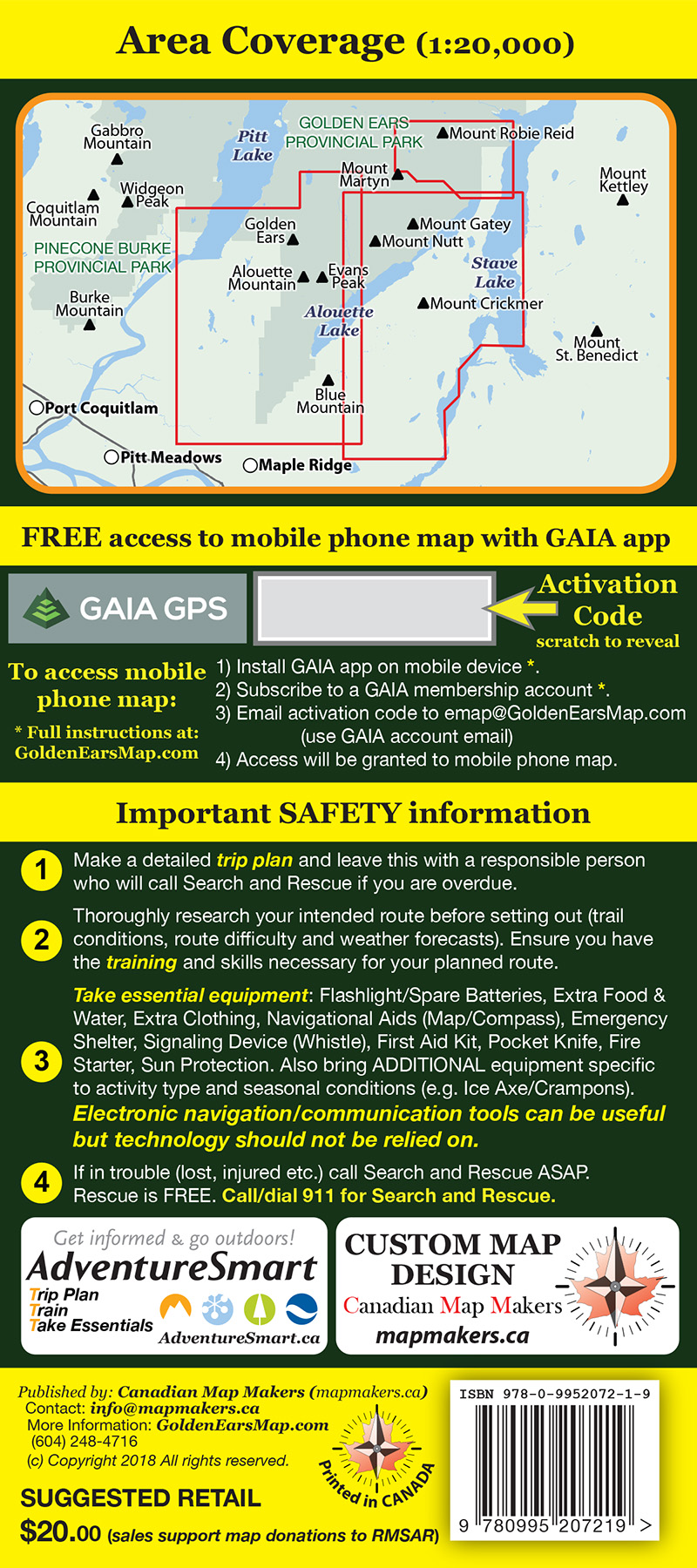
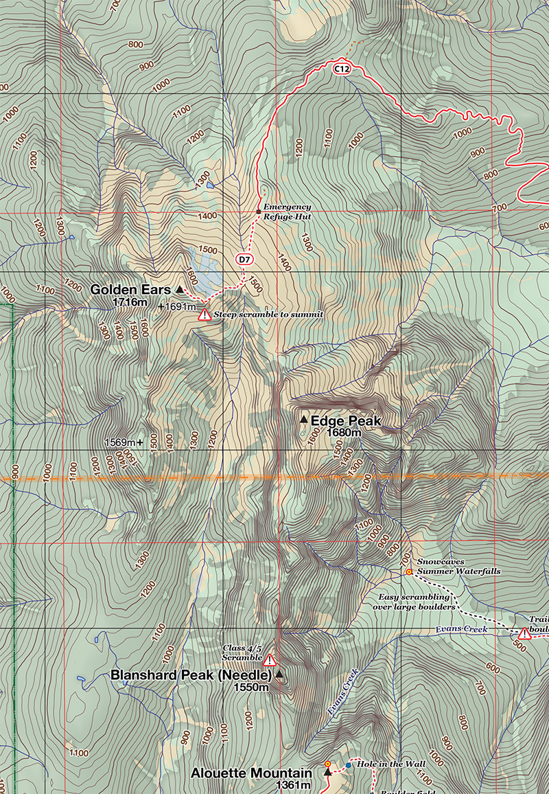
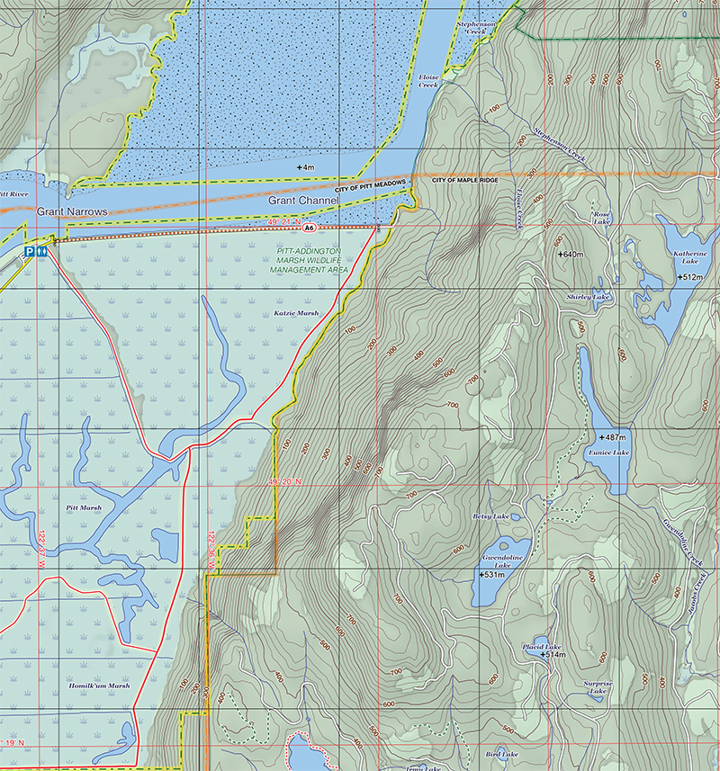
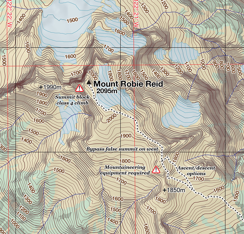
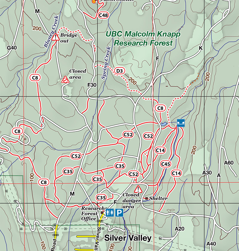
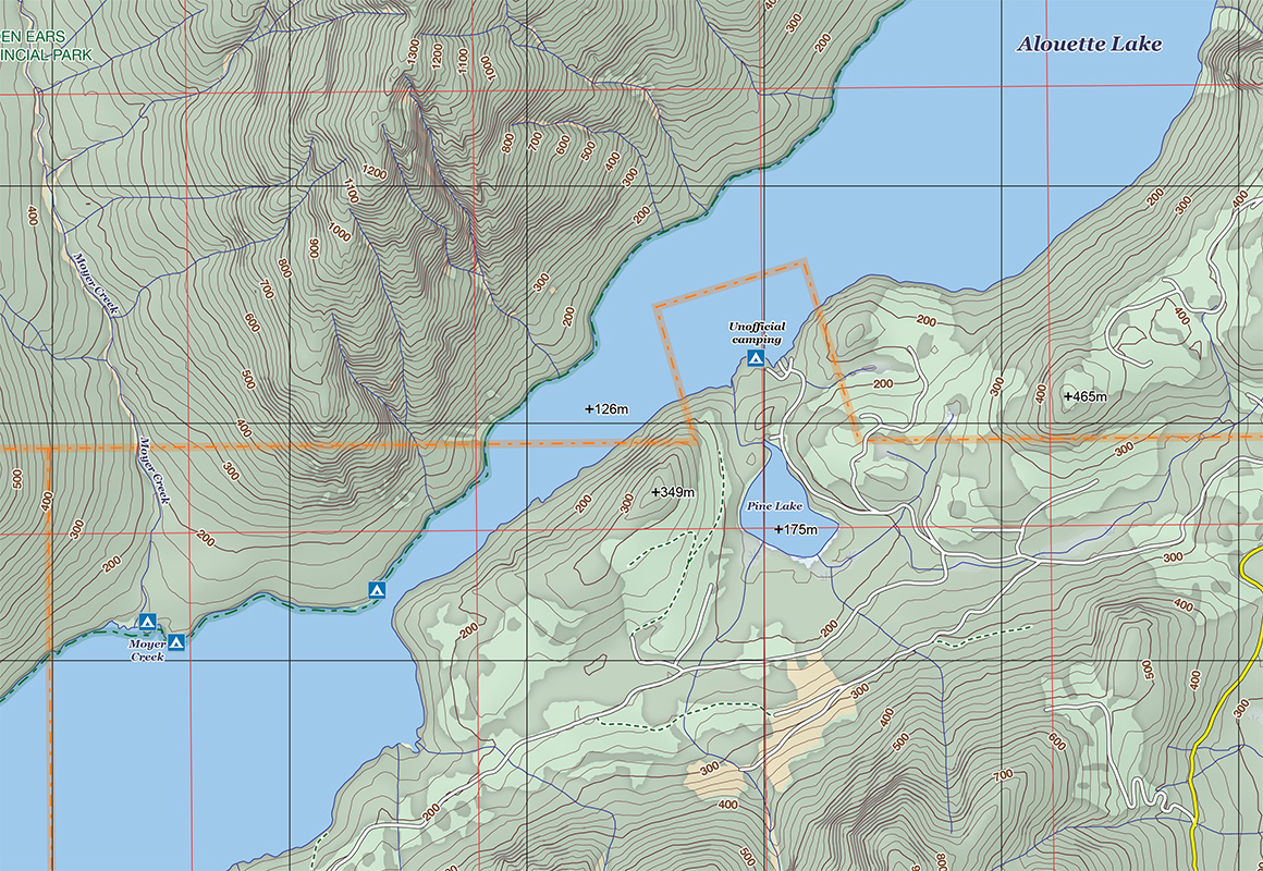
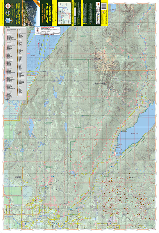
Comprehensive topo trail map covering GOLDEN EARS PROVINCIAL PARK including all the park trails, Mount Robie Reid, Blue Mountain Moto Trails, Woodlot Mountain Biking Area, Alouette Lake, Stave Lake (West) and Northern Maple Ridge. Produced by Canadian Map Makers, this 1:20,000 scale map spans from Pitt Lake to Stave Lake to Mount Robie Reid. Printed on durable and waterproof synthetic paper making it ideal for tough weather conditions.
Find Out More


Thanks for creating this fantastic, right-up-to-date map that will result in safer hiking for many people. I am honoured to receive one!
Been pouring over it since I got it. Thanks Steve
Love your maps they are great.
Purchased. Great maps btw!
Fantastic, thanks Steve. I love your maps!
I really love your Golden Ears map, can’t wait to get the Tri-Cities map.